
- Length – 5.6 Km
- Elevation – 883m
- Difficulty – Hard
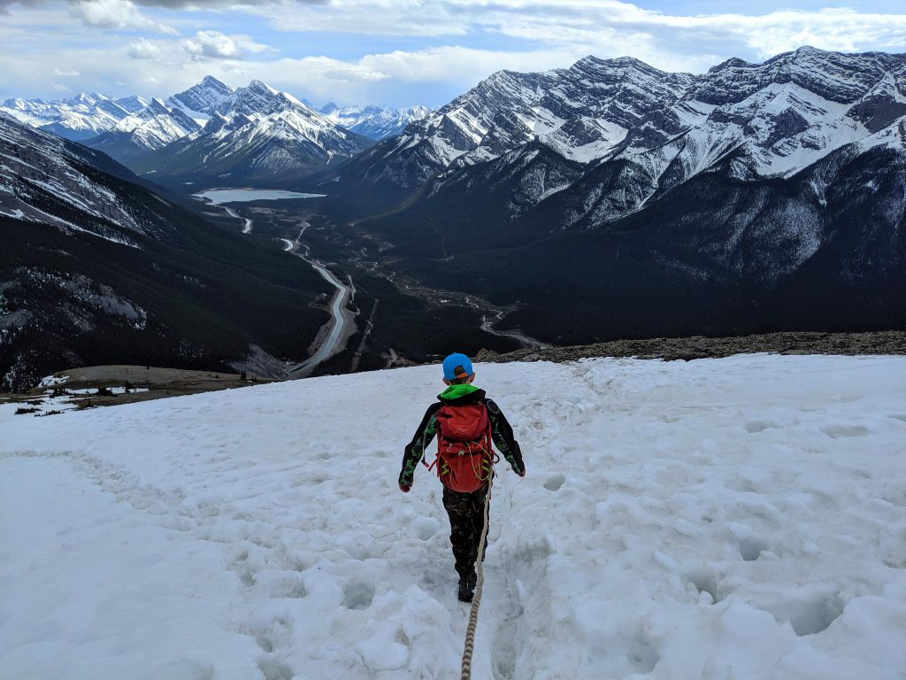
Yesterday my son and I decided to hike up EEOR. Rundle is actually a huge mountain that stretches from Canmore all the way to Banff. EEOR is the east end (obviously) and is the section closest to Canmore. Conditions were perfect, it was 15 degrees and a cloudy day but all the clouds were above the peak so that didn’t bother us. Trail was dry and with the exception of a small portion near the top there is no snow left on the trail.
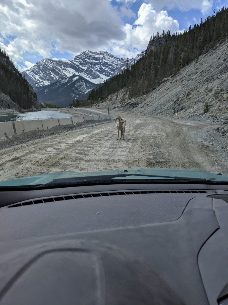
The trailhead is located on the Three sisters parkway. Follow the parkway past the Grassi lake turn, the pavement will turn to gravel. The road isn’t in the best shape and it can be busy with not only cars but animals, cyclists and pedestrians. You will see a series of pullouts at Whitemans Pond. Pass the first pullout (with the outhouse) and park in either one of the other 2 further down the road. If you reach Ha Ling then you’ve gone to far. The trail head for EEOR is not marked. From the parking lot cross the road and you should see a small path, that is your trailhead.
Before I get in to the hike itself, lets talk about difficulty. As far as mountain Hikes go, this isn’t a difficult one. I’d rate the hiking portion as moderate, however there is quite a bit of scrambling on this trail which ups the overall difficulty to hard. I rate hikes based off my fitness abilities so please keep in mind, if you are just getting in to hiking or you are not as fit as you’d like to be you may find this hike more difficult.
If you are unaware, scrambling is when you have to use your hands (sometimes knees and butts) to navigate the terrain. EEOR is a fantastic beginner scramble. I say this because well there is quite a few sections where you will possibly be using your hands, there is very little exposure and therefore the risk of serious injury or death is low.

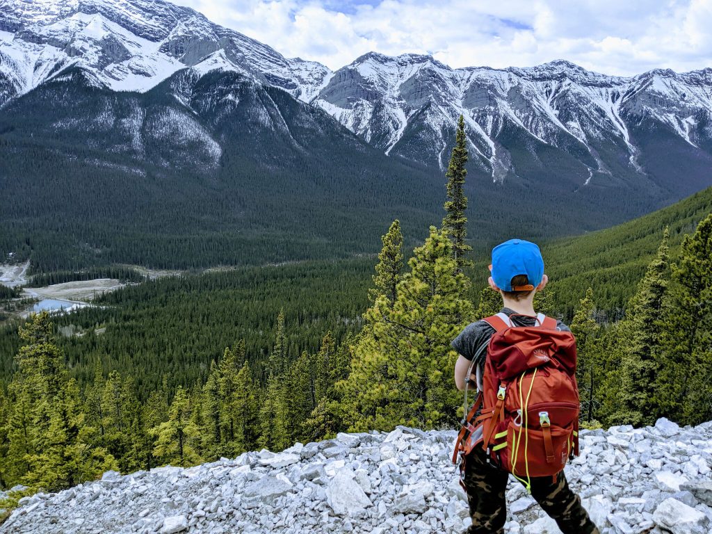
Lets get to the hike. The beginning of the trail is through the trees and the path is well worn and easy to follow. You will be gaining a significant amount of elevation the whole way.

The trail continues up and once you are through the thickest part of the trees you are rewarded with one of my favourite views. From here the fun and confusion begins. The trail becomes less apparent as people have created their own roots to scramble up different sections of rocks. All in all though the paths usually converge back onto the main trail.
Eventually the trail goes right to the edge of the mountain. This is the most exposed you will be on EEOR and this is where I chose to attach my son to me. He would remain attached until we got passed this point again on the way down.

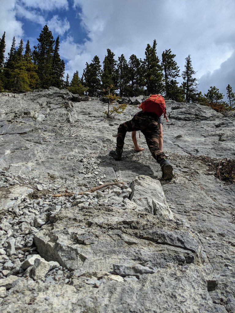
From there the scrambling becomes a little more difficult but still very manageable. This was my sons favourite part. He had a blast picking routes and monkeying his way up.
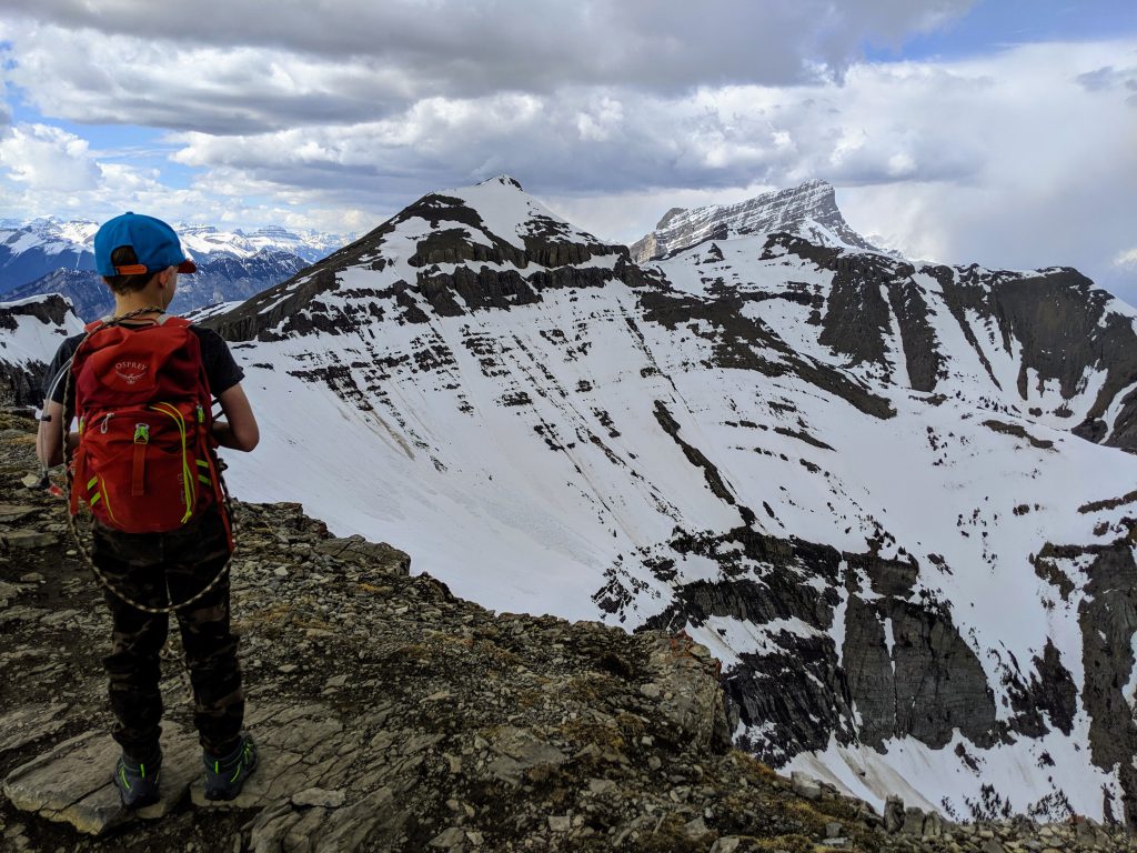
Once we passed the trees we were rewarded with fresh, cold water flowing in small streams from the ground. Here the trail splits into 2, if you stay to the left you will get to the peak. The right offers up some really sick views as well. We stayed left and then crossed the scree to the other trail on our way down. The trails makes it way through some scree and then through snow, very very soft snow. I sank to my knees more then once. I would assume by June the snow will be completely melted.
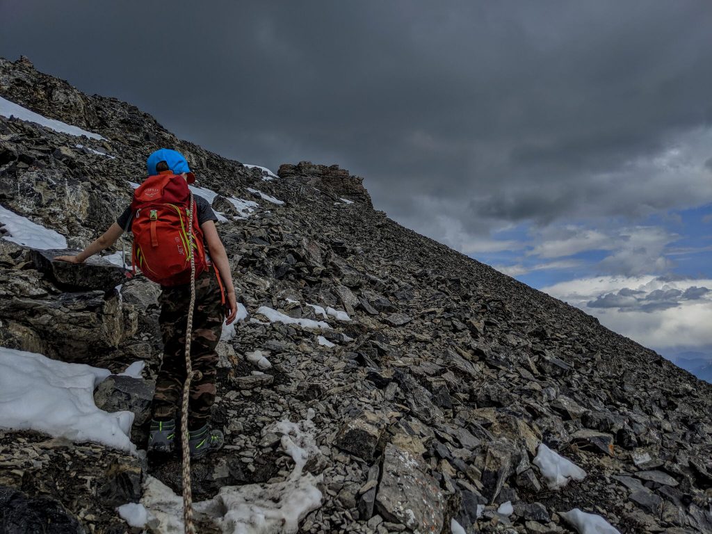
Essentially once you are passed the tree line you will be hiking on scree. Scree is basically just a bunch of loose rock. This can be tricky and a little scary as the ground can slip out from under you. This is especially dangerous if people are hiking below you as rocks being kicked out by hikers can and do kill people.

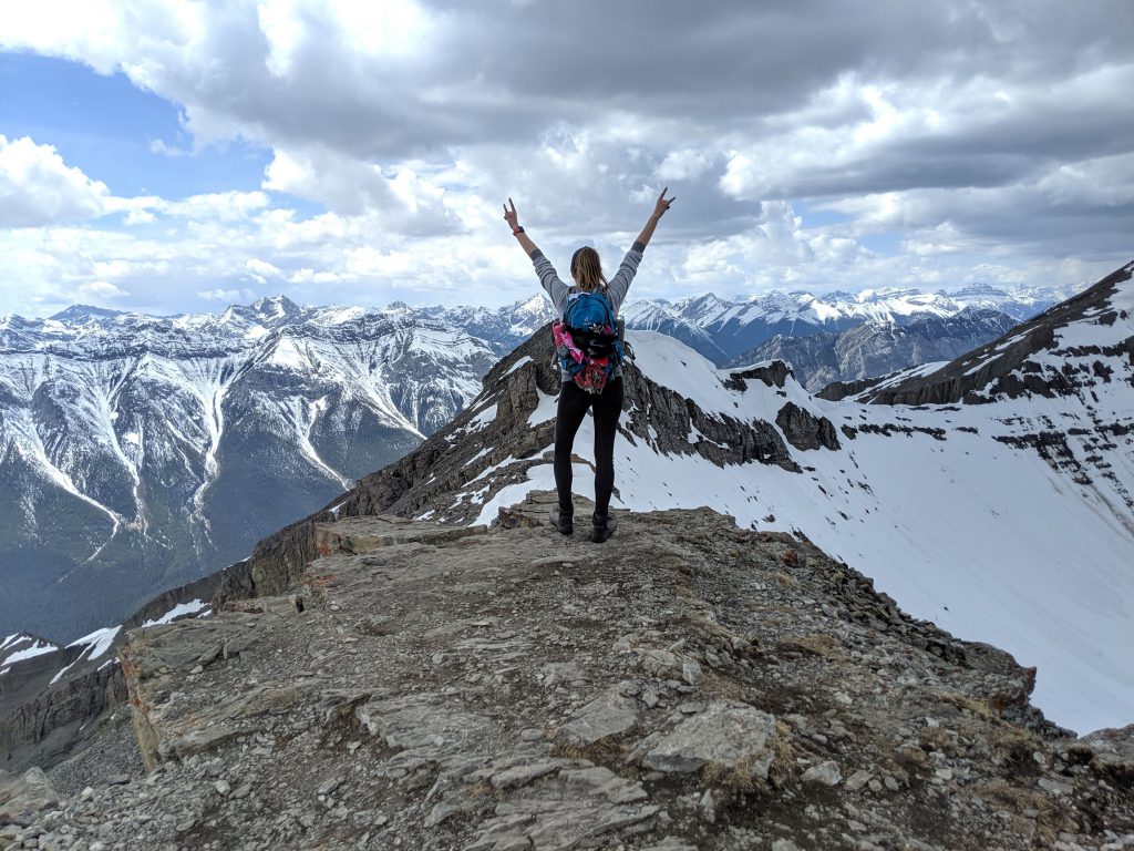
There is one more small section of scrambling to get to the top. When you pull yourself up over that final ledge the view is mind blowing. Make sure you look for the little ammo box, it contains pens and papers and you can sign your name or leave a little message for others.
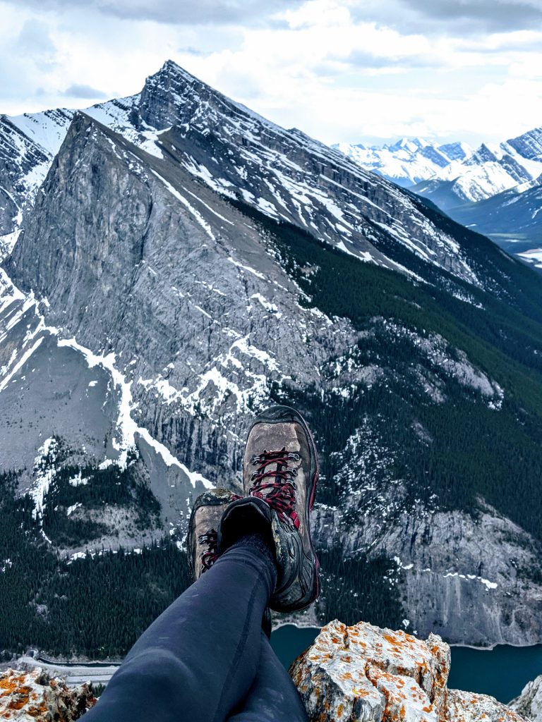

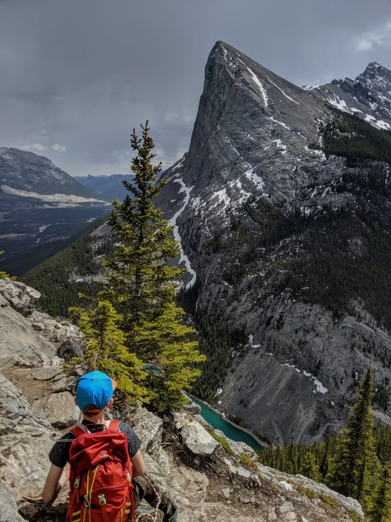
After the summit we headed back down the slope a little ways and then crossed the scree to meet up with the other path. Remember those sick views I was talking about? It takes you to a ledge and you get a really good view of Three Sisters. If you aren’t quite ready to go all the way to the summit, I highly suggest sticking to the right when the path forks, you will skip the worst of the scrambling, most of the scree and you will still be rewarded.

To recap, this is a fantastic beginner scramble. You don’t have to make it all the way to the top to be rewarded and there is very little exposure and risk of death. The hike itself is moderate to hard depending on your fitness level. I do not recommend bringing children on this hike unless they are experienced hikers and you are confident in both your abilities as well as theirs. It took us around 4 hours to do with lots of stops for pictures and 15 minutes on the summit. Happy Hiking!